その他
Landslide Distribution Maps WMS
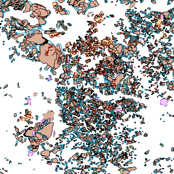
Landslide Distribution Maps are available as a Web Map Service (WMS) from J-SHIS.
Table of contents
URL
WMS version
WMS request
Optional parameter
Layer
Coordinate reference system (CRS)
Limitation
Request Sample
URL
A response in Japanese
http://www.j-shis.bosai.go.jp/map/wms/landslide?
A response in English
http://www.j-shis.bosai.go.jp/map/wms/landslide?LANG=en
WMS version
This service supports WMS versions 1.1.1 and 1.3.0.
WMS request
Following WMS operations are available.
- GetCapabilities
- GetMap
- GetLegendGraphic
- GetFeatureInfo
Optional parameter
In addition to WMS standard parameters, following optional parameters are available.
Note) The parameters are case-insensitive.
| Parameter | Input values and Description |
|---|---|
| LANG | Response language
Note) Response is in Japanese if this parameter is not given. |
Layer
Following Landslide layers are available.
| Landslide type | Layer name | Remarks |
|---|---|---|
| Boundary Structures (Main scarp and lateral scarp (flank)) | L-V3-S100 | These layers are available when scale is 1/200,000 or less. |
| Boundary Structures (Margin of moving mass) (Outline) | L-V3-S200 | |
| Boundary Structures (Margin of moving mass) (Boundary) | L-V3-S300 | |
| Interior Structures | L-V3-S400 | |
| Movement Direction and Main Moving Direction of the Mass | L-V3-S500 | |
| Centroid of moving mass | L-V3-CENTER | This layer is available when map scale is greater than 1/200,000. |
| All of the above | L-V3-ALL |
Coordinate reference system (CRS)
Following CRSs are available.
| EPSG code | CRS |
|---|---|
| 4301 | Tokyo |
| 4326 | WGS84 |
| 4612 | JGD2000 |
| 900913 | Google Mercator |
Limitation
The WIDTH and HEIGHT parameters must NOT be more than 4096.
Request Sample
GetCapabilities
GetMap

An example of WMS response

